
How to Check If Land Is in a Flood Zone (And Why It Matters)
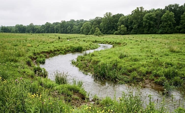
A creek through the property is one of the best features rural land can have — until the first spring you watch it leave its banks. Water is the feature buyers pay extra for and the risk they most often forget to check.
The good news: flood risk is one of the easiest pieces of due diligence in all of land buying. The federal government maps it, publishes it, and lets you look it up for free in about five minutes.
Here’s how to check any parcel, what the zone designations actually mean, and how to think about flood risk on rural land.
How to Look Up a Flood Zone in Five Minutes
The Federal Emergency Management Agency (FEMA) maintains flood maps for most of the country, and they’re the same maps lenders and insurers use.
- Go to the FEMA Flood Map Service Center at msc.fema.gov.
- Search the property — by address if it has one, or by dropping a pin on the map for raw land.
- Read the zone shading — high-risk areas appear as shaded zones labeled A or AE; everything else is Zone X or unshaded.
- Save the FIRMette — the site lets you print a free official map snippet for your records.
For parcels without an address, the county GIS map is a helpful companion — many counties overlay FEMA flood layers directly on their parcel viewer, so you can see exactly where the flood zone crosses your acreage.
What the Zone Codes Mean
Zones A and AE — High Risk
These are Special Flood Hazard Areas, land with a 1 percent chance of flooding in any given year — the so-called 100-year floodplain. Zone AE includes detailed elevation data; plain Zone A means the area was mapped without it, common in rural counties.
Zone X — Moderate to Minimal Risk
Most land falls here. Shaded X marks the 500-year floodplain; unshaded X is everything above it.
One Honest Caveat
Flood maps are a starting point, not a guarantee. Roughly a quarter to a third of federal flood insurance claims come from properties outside mapped high-risk zones. Small rural creeks often aren’t studied in detail, so walk the land, look for debris lines and water-stained tree trunks, and ask neighbors what the low spots do in a wet spring.
What a Flood Zone Means for Your Plans
A flood zone on part of a parcel is information, not a verdict. What matters is how it lines up with your plans.
- Building a home — building in a mapped floodplain triggers elevation requirements and permits, and flood insurance becomes mandatory with most financed construction. The simple answer: put the homesite on high ground.
- Recreational use — creek bottoms flood, and hunters, campers, and hikers mostly don’t care. Bottomland is often the best wildlife habitat on a property precisely because it’s wet.
- Resale — a parcel that’s entirely floodplain limits future buyers; a parcel with a buildable upland portion and a wet bottom is a normal, healthy piece of rural land.
- Insurance — vacant land itself doesn’t need flood insurance; the question only arises when you build.
Turning Flood Knowledge into Negotiating Power
Smart buyers use the flood map the way they use a survey: to price the land accurately. If a third of a tract lies in Zone A, you’re really buying two kinds of land — buildable upland and recreational bottomland — and the price should reflect the mix.
Sellers who know their land will tell you this up front. When a listing mentions a creek, the next sentence should answer the obvious question, and a five-minute map check confirms it. That’s not suspicion — that’s just how careful buyers become happy landowners.
A Quick Pre-Offer Checklist
- Pull the FEMA map and note which zones touch the parcel.
- Overlay the county GIS to see where the zone line crosses your acreage.
- Walk the low ground after rain if you can, and look for debris lines.
- Ask the seller and neighbors what the creek does in a wet year.
Buy Land with Confidence from Classic Country Land
Knowing what you’re buying is the whole game in rural land, and it’s how Classic Country Land has done business for more than 25 years. Our listings describe properties honestly — water features, terrain, access, and all — so the parcel you walk matches the parcel you pictured.
Every property comes with in-house owner financing: no credit or background checks, down payments starting at just $999 plus a one-time $249 document fee at closing, and fixed monthly payments that make ownership simple. With properties across 14 states, you can find high, dry building ground, creek-bottom hunting land, or a parcel that gives you both.
Browse current listings at classiccountryland.com or call 972-649-6200. Check the map, walk the land, and buy with your eyes open.
A creek through the property is one of the best features rural land can have — until the first spring you watch it leave its banks. Water is the feature buyers pay extra for and the risk they most often forget to check.
The good news: flood risk is one of the easiest pieces of due diligence in all of land buying. The federal government maps it, publishes it, and lets you look it up for free in about five minutes.
Here’s how to check any parcel, what the zone designations actually mean, and how to think about flood risk on rural land.
How to Look Up a Flood Zone in Five Minutes
The Federal Emergency Management Agency (FEMA) maintains flood maps for most of the country, and they’re the same maps lenders and insurers use.
- Go to the FEMA Flood Map Service Center at msc.fema.gov.
- Search the property — by address if it has one, or by dropping a pin on the map for raw land.
- Read the zone shading — high-risk areas appear as shaded zones labeled A or AE; everything else is Zone X or unshaded.
- Save the FIRMette — the site lets you print a free official map snippet for your records.
For parcels without an address, the county GIS map is a helpful companion — many counties overlay FEMA flood layers directly on their parcel viewer, so you can see exactly where the flood zone crosses your acreage.
What the Zone Codes Mean
Zones A and AE — High Risk
These are Special Flood Hazard Areas, land with a 1 percent chance of flooding in any given year — the so-called 100-year floodplain. Zone AE includes detailed elevation data; plain Zone A means the area was mapped without it, common in rural counties.
Zone X — Moderate to Minimal Risk
Most land falls here. Shaded X marks the 500-year floodplain; unshaded X is everything above it.
One Honest Caveat
Flood maps are a starting point, not a guarantee. Roughly a quarter to a third of federal flood insurance claims come from properties outside mapped high-risk zones. Small rural creeks often aren’t studied in detail, so walk the land, look for debris lines and water-stained tree trunks, and ask neighbors what the low spots do in a wet spring.
What a Flood Zone Means for Your Plans
A flood zone on part of a parcel is information, not a verdict. What matters is how it lines up with your plans.
- Building a home — building in a mapped floodplain triggers elevation requirements and permits, and flood insurance becomes mandatory with most financed construction. The simple answer: put the homesite on high ground.
- Recreational use — creek bottoms flood, and hunters, campers, and hikers mostly don’t care. Bottomland is often the best wildlife habitat on a property precisely because it’s wet.
- Resale — a parcel that’s entirely floodplain limits future buyers; a parcel with a buildable upland portion and a wet bottom is a normal, healthy piece of rural land.
- Insurance — vacant land itself doesn’t need flood insurance; the question only arises when you build.
Turning Flood Knowledge into Negotiating Power
Smart buyers use the flood map the way they use a survey: to price the land accurately. If a third of a tract lies in Zone A, you’re really buying two kinds of land — buildable upland and recreational bottomland — and the price should reflect the mix.
Sellers who know their land will tell you this up front. When a listing mentions a creek, the next sentence should answer the obvious question, and a five-minute map check confirms it. That’s not suspicion — that’s just how careful buyers become happy landowners.
A Quick Pre-Offer Checklist
- Pull the FEMA map and note which zones touch the parcel.
- Overlay the county GIS to see where the zone line crosses your acreage.
- Walk the low ground after rain if you can, and look for debris lines.
- Ask the seller and neighbors what the creek does in a wet year.
Buy Land with Confidence from Legacy Land
Knowing what you’re buying is the whole game in rural land, and it’s how Legacy Land has done business for more than 25 years. Our listings describe properties honestly — water features, terrain, access, and all — so the parcel you walk matches the parcel you pictured.
Every property comes with in-house owner financing: no credit or background checks, down payments starting at just $999 plus a one-time $249 document fee at closing, and fixed monthly payments that make ownership simple. With properties across 14 states, you can find high, dry building ground, creek-bottom hunting land, or a parcel that gives you both.
Browse current listings at classiccountryland.com or call 972-649-6200. Check the map, walk the land, and buy with your eyes open.