

Moonrise Meadows is a 160 +/- acre parcel of land that sits within the beautiful countryside of rural Oklahoma. This property is located just 11 miles southwest of Okemah, Oklahoma, and offers access to power along the county road, as well as a wet weather creek running along the east side. With cities like Shawnee, OK, and Tulsa within easy driving distance. Moonrise Meadows is a great choice for those who want an escape to the countryside, with the convenience of larger cities.
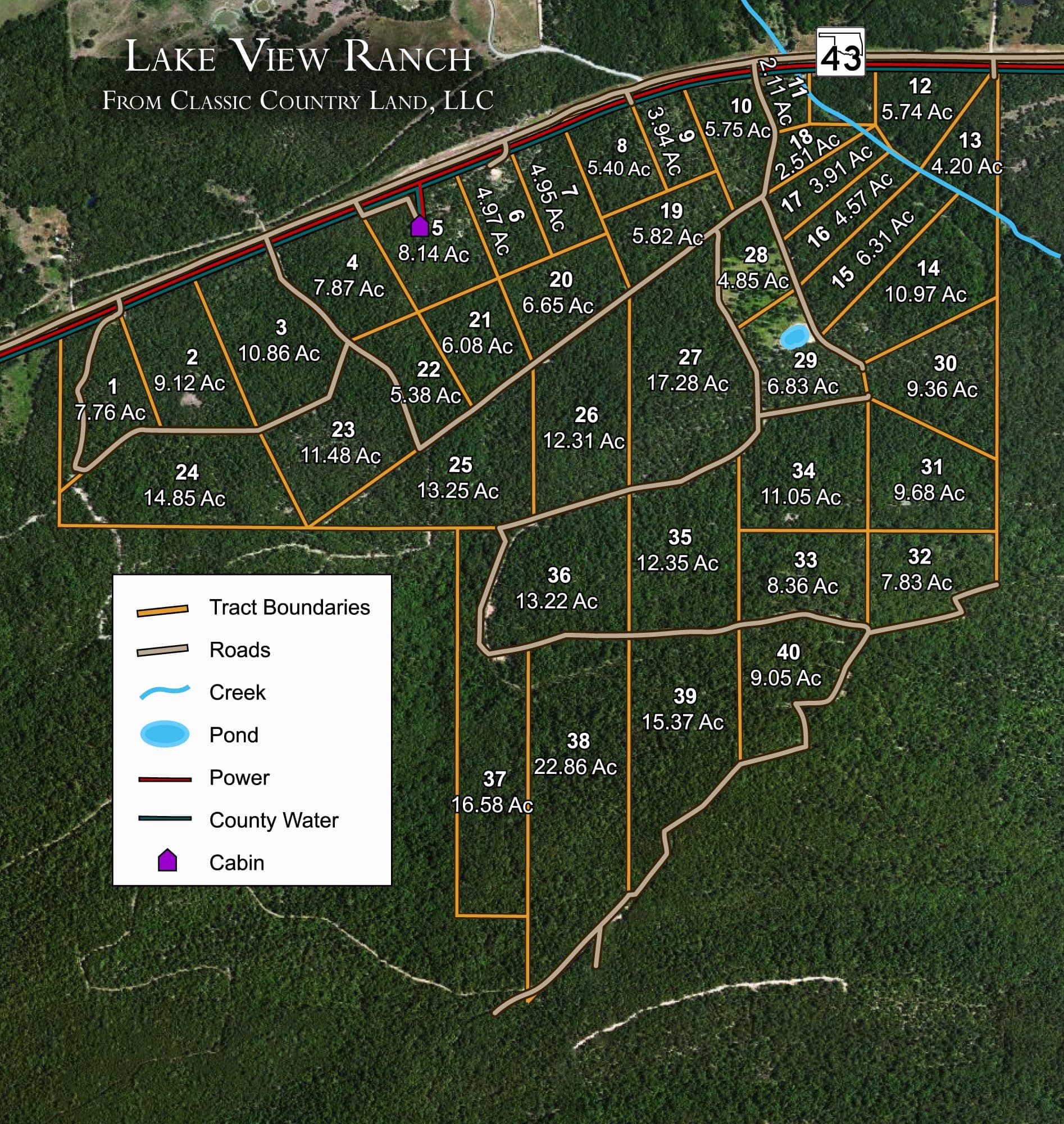
Tract 15 is located along a private dirt road just south of Sardis Lake off of State Highway 43. There are two ways to access this lot from the small trail across the northern boundary and a road along the southern boundary north of the pond. The tract has been surveyed and flagged with stakes and survey pins for all corners. Tree cover is moderate to heavy and with some moderate clearing has many nice building spots to offer. Oak and short leaf pine are mostly dominant in this area. Maxwell Creek runs along the northern boundary of this property, so you have creek frontage year round. If camping, hunting or building a mountain cabin is your desire, this property would be perfect for any of these recreational purposes.
Land Specifics
- County / State
- Pushmataha County, Oklahoma
- Acreage & Dimensions
- 6.31 acres
- Road Access
- Bordered by Oklahoma Hwy 43 on the north
- Terrain
- Elevation change of over 600 feet, gently climbing land transitioning to more severely rising slopes up to Flagpole Mountain; fully wooded with oak and shortleaf pine
Property Map
Property Video Tour
Location & Directions
Feel free to visit in person! Some properties have locked gates, so please contact us before making the trip!
Property Documents
FAQs
Location & Utilities
Where is the property located?
What improvements have been made?
What about utilities?
What will the road surface be like?
Financing
What is the minimum down payment amount to purchase and are there closing costs?
If I finance the property, to whom do I make my payments and how will I know I have received proper credit for my payments?
May I use the land while I'm paying for it and when do I receive a deed to my property?
Is there a penalty for paying off my land early?
Does a buyer have to build a house within a certain time frame?
Can I resell my property in the future and make a profit?
Can I make an offer and what kinds of discounts are available?
Why are some properties more expensive than others?
How does the contract-for-deed process work?
Elevation & Weather
What is the average elevation of the property?
What is the average temperature throughout the year?
Zoning & Taxes
What zoning applies to the property, and what are the property taxes for the parcel?
Land Use & Rights
Are mineral rights included?
Is there an hoa or poa?
Can I camp or park an rv on my land?
Are mobile or manufactured homes allowed?
Is hunting allowed?
★ You may also like:
Canyon Creek is a 154+/- acre parcel of land that is ideally located in rural central Oklahoma. Being located in Lincoln County, OK, that provides this property with a mixture of rural landscapes, including rolling hills and picturesque ponds. The surrounding area is dotted with small towns and communities, with Chandler being the largest and Stroud being the nearest. You'll find a blend of agricultural fields, open pastures, and wooded areas, giving Canyon Creek a serene, countryside feel.
Deep Fork Ranch is located in Okfuskee County, Oklahoma. With Lake Henryetta about 15 miles away, this is the perfect weekend getaway property. Just outside of the town of Henryetta, Deep Fork Ranch is also within easy driving distance of larger cities such as Oklahoma City and the DFW metroplex. This makes it especially attractive to landowners who want both the relaxation of the countryside as well as the convenience of a bigger city.


